Topographic Surveys: Everything You Need to Know
The topographic survey is an accurate depiction of the site (property, land area, defined boundaries), scaled and detailed according to spatial considerations, and is a summary of the data collection process at the site. This type of survey is a detailed process that requires the knowledge of topology professionals to ensure the accuracy of all reports provided.
Property surveyors in Birmingham make use of topographic surveys for a variety of purposes. It’s mostly needed when beginning construction of a new project to find out details of the land and spaces.
What is Topography?
Topography is the study of the shape and characteristics of the earth’s surface. The topography of an area refers to the shape and characteristics of the surface on the ground and its arrangement. The traditional definition requires topographic maps to show both natural and man-made features.
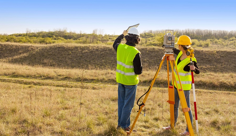
How is a Topographic Survey Carried Out?
Topographic surveys collect data on the natural and man-made features of the land, as well as the topography. Permanent features such as buildings, fences, trees, and streams precisely define the terrain and its boundaries. The terrain outline and the point level show the elevation of the terrain. Topographic maps are used by architects, engineers, construction contractors, and others to accurately visualize their site and promote development.
Types of Topographic Survey
The types of topographic surveys available include general land surveys, boundary surveys, and construction project surveys. Also, according to the required map scale and the location of the location (for example, if it is an urban or rural area), the survey can be classified by level of precision. The topographic survey process includes:
- collecting information, that is, the geographic area to be included.
- the level of detail, precision and the data output schedule and price.
- collecting survey data in situ.
- processing the data and preparing the final result of the survey.
How Long does the Investigation Take?
The duration of the topography measurement process depends on the size of the area to be covered and the complexity of the topography being measured. Once the time required is calculated, a work plan is developed. This may include additional resources to meet specific project plan milestones or other deadlines.
What are Topographic Maps Used for?
Topographic maps are often used as the basis for design decisions. Architects or consulting engineers will need an accurate digital plan of their site area to generate good design and construction drawings. The survey and data can also be used for other purposes, including new housing developments, new road designs, submission of land registration forms, or volume calculations.
Equipment for Measuring
All measurement points are measured by an instrument with a built-in feature code list. For example, a surveyor can chain measurement points to create the outline of a building using a specific code. Depending on site specifications and topography, GPS and laser scanning equipment can also be used.
The result depends on the customer’s needs. For example, if a client presents an investigation for the purpose of the Land Registry, a certain scale and result is required to comply. Thorough investigation of all functions is essential for planning, design and construction. Any item not investigated will cause costly delays at any stage of development.
How Much does a Land Survey Usually Cost?
The cost is based on the time needed to dedicate to the project. The time is calculated based on the area of the site, the terrain and the range of visibility. The specification will also detail the functions to investigate.
Leading property surveyors carry out topographic surveys using specialized equipment and expert professionals to make the calculations accurate. If you are looking for expert property surveyors in Birmingham to carry out any type of surveys, you can always trust us to provide you with the best services.